


DeSoto Central Voting District, DeSoto County, Mississippi
About
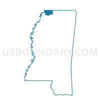
Outline

Summary
| Unique Area Identifier | 605305 |
| Name | DeSoto Central Voting District |
| County | DeSoto County |
| State | Mississippi |
| Area (square miles) | 9.74 |
| Land Area (square miles) | 9.71 |
| Water Area (square miles) | 0.03 |
| % of Land Area | 99.72 |
| % of Water Area | 0.28 |
| Latitude of the Internal Point | 34.92448220 |
| Longtitude of the Internal Point | -89.96225350 |
Maps


Graphs
Select a template below for downloading or customizing gragh for DeSoto Central Voting District, DeSoto County, Mississippi


Neighbors
Neighoring Voting District (by Name) Neighboring Voting District on the Map
- Aldens Voting District, DeSoto County, MS
- Bridgetown Voting District, DeSoto County, MS
- Elmore Voting District, DeSoto County, MS
- Horn Lake East Voting District, DeSoto County, MS
- Nesbit East Voting District, DeSoto County, MS
- Pleasant Hill North Voting District, DeSoto County, MS
- Southhaven South Voting District, DeSoto County, MS
Top 10 Neighboring County Subdivision (by Population) Neighboring County Subdivision on the Map
- District 5, DeSoto County, MS (38,509)
- District 2, DeSoto County, MS (30,691)
- District 4, DeSoto County, MS (20,393)
Top 10 Neighboring Place (by Population) Neighboring Place on the Map
Top 10 Neighboring Unified School District (by Population) Neighboring Unified School District on the Map
Top 10 Neighboring State Legislative District Lower Chamber (by Population) Neighboring State Legislative District Lower Chamber on the Map
- State House District 6, MS (46,182)
- State House District 40, MS (32,431)
- State House District 7, MS (30,501)
- State House District 25, MS (29,000)
Top 10 Neighboring State Legislative District Upper Chamber (by Population) Neighboring State Legislative District Upper Chamber on the Map
Top 10 Neighboring 111th Congressional District (by Population) Neighboring 111th Congressional District on the Map
Top 10 Neighboring Census Tract (by Population) Neighboring Census Tract on the Map
- Census Tract 706.30, DeSoto County, MS (10,079)
- Census Tract 706.20, DeSoto County, MS (7,131)
- Census Tract 706.10, DeSoto County, MS (3,001)